Urban environments are increasingly vulnerable to extreme weather and rising temperatures. As cities in regions like Saudi Arabia continue to grow and expand, understanding temperature behavior becomes a critical aspect of sustainable development. One of the most powerful tools guiding this process is the temperature mapping study—a detailed analysis that reveals how heat distributes differently across coastal and inland regions. At Redlines (www.redlines.sa), we specialize in delivering precise temperature mapping services in Jeddah, Dammam, Riyadh, and across Saudi Arabia to empower smarter urban planning and environmental decision-making.
Why Temperature Mapping Matters
Temperature mapping is a scientific method used to monitor and visualize the variations in temperature across different geographic zones. Whether it’s the breezy coastal corridors of Jeddah and Dammam or the more arid and enclosed landscapes of Riyadh, every urban area has a unique thermal fingerprint. Through a comprehensive temperature mapping study, urban planners, architects, and government bodies can make informed choices about infrastructure placement, energy efficiency, and public health strategies.
Coastal vs. Inland: Two Different Heat Realities
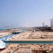
The contrast between coastal and inland heat patterns is significant. Coastal cities like Jeddah and Dammam are moderated by nearby bodies of water, which help to stabilize temperatures and reduce the severity of heatwaves. In contrast, cities like Riyadh, located inland, often experience greater thermal fluctuations, with intense daytime heat and cooler nights.
A temperature mapping study in these environments highlights how built infrastructure, vegetation, and wind flow interact with natural heat behavior. For example, coastal cities may require more moisture-resistant materials, while inland cities might prioritize reflective roofing and shaded street designs to combat urban heat islands.
Temperature Mapping and Urban Planning Integration
Urban planning without environmental data is incomplete. Temperature mapping studies inform critical decisions such as:
- Zoning laws and green space allocation
High-heat zones identified through mapping help planners prioritize parks, urban forests, and reflective pavements in key areas. - Building orientation and material selection
Structures can be designed to minimize heat absorption in hotter inland cities or maximize natural ventilation in coastal areas. - Energy usage optimization
With clear heat data, cities can reduce cooling costs through passive design strategies and improved HVAC planning. - Public health improvements
Hot zones often correlate with health risks such as heatstroke or respiratory issues. Temperature mapping studies enable city officials to deploy cooling centers and public health campaigns where they’re most needed.
At Redlines, we conduct meticulous temperature mapping studies using industry-standard equipment and cutting-edge software. Our team has experience working across Saudi Arabia, providing customized thermal analysis and urban planning insights in Jeddah, Dammam, Riyadh, and more.
Supporting Saudi Arabia’s Vision 2030
Saudi Arabia’s Vision 2030 aims to build sustainable, livable cities. Temperature mapping is a key part of achieving this. By bridging environmental science with urban strategy, cities can reduce their carbon footprint, lower energy consumption, and create healthier living environments.
Redlines is proud to support this national initiative by offering reliable temperature mapping services to both governmental and private-sector clients. From high-rise developments to industrial zones and residential neighborhoods, our tailored studies help shape cities that are better adapted to their natural climates.
Conclusion
As the climate continues to evolve, data-driven urban planning becomes more important than ever. The comparison between coastal and inland heat patterns showcases the vital role of temperature mapping studies in guiding infrastructure, health, and energy decisions. In cities like Jeddah, Dammam, and Riyadh, leveraging these insights ensures a more sustainable and resilient future.
To learn more or to schedule a consultation, visit www.redlines.sa. At Redlines, we bring clarity to heat—one map at a time.