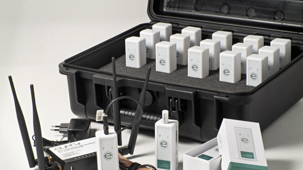
In the ever-evolving landscape of urban development, one tool has emerged as essential in designing sustainable, efficient, and comfortable cities: the temperature mapping study. As global temperatures continue to rise and urban areas grapple with the heat island effect, temperature mapping offers critical data that helps urban planners and environmental consultants create smarter, more resilient environments. At Redlines (www.redlines.sa), we specialize in delivering temperature mapping services across Saudi Arabia, particularly in Jeddah, Dammam, Riyadh, and other key cities, supporting the transformation of urban landscapes through data-driven decisions.
What is a Temperature Mapping Study?
A temperature mapping study involves the systematic measurement and analysis of temperature distribution across specific spaces over a set period. In the context of urban planning, this study helps identify temperature variations in different city zones, highlighting hotspots and cooler areas. The data collected can reveal patterns related to infrastructure materials, vegetation cover, traffic density, and the presence of water bodies, all of which contribute to local temperature fluctuations.
By understanding these dynamics, urban designers can make informed choices in positioning green spaces, selecting building materials, and configuring the urban layout to optimize thermal comfort and energy efficiency.

Urban Heat Islands and the Need for Temperature Mapping
One of the most pressing challenges in modern urban environments is the urban heat island (UHI) effect. UHIs occur when cities experience higher temperatures than surrounding rural areas due to human activities and infrastructure such as asphalt roads and concrete buildings. This effect can significantly impact energy consumption, public health, and environmental quality.
A comprehensive temperature mapping study is key to identifying UHI zones. By collecting temperature data at various times of day and across different seasons, urban planners can pinpoint which neighborhoods require mitigation strategies—such as increased tree planting, reflective roofing, or improved ventilation corridors.
At Redlines, we provide specialized temperature mapping solutions that cater to the unique climatic conditions of Saudi Arabia. Whether it’s the coastal humidity of Jeddah, the arid heat of Riyadh, or the industrial zones of Dammam, our studies are customized to the specific urban microclimates, enabling cities to combat heat-related challenges effectively.
Enhancing Urban Design Through Temperature Mapping
Temperature mapping isn’t just a tool for identifying problems—it’s a blueprint for innovation. Armed with accurate thermal data, urban designers can implement changes that make cities more livable. For instance:
- Landscape design: Introducing shaded areas, green roofs, and water features in strategic locations based on temperature data.
- Material selection: Using reflective and breathable materials for pavements and buildings in hotter zones.
- Smart zoning: Planning residential, commercial, and industrial zones based on temperature suitability to minimize heat exposure and energy usage.
At Redlines, our team combines temperature mapping with other environmental assessments to provide holistic urban design recommendations. Our services are trusted by municipalities, real estate developers, and sustainability consultants throughout Saudi Arabia, including projects in Jeddah, Dammam, and Riyadh.
Why Choose Redlines?
With a deep understanding of both local climates and global best practices, Redlines stands at the forefront of urban environmental consultancy. Our temperature mapping studies are conducted using advanced equipment and software, ensuring precision and actionable insights. More importantly, we don’t just deliver data—we offer solutions tailored to your city’s goals, whether it’s improving public health, reducing energy costs, or achieving sustainability targets.
For urban projects looking to integrate temperature-sensitive design, partnering with Redlines means aligning with a team that prioritizes data accuracy, environmental integrity, and regional expertise. Learn more about our services and case studies by visiting www.redlines.sa.
Final Thoughts
As cities in Saudi Arabia continue to expand, the importance of sustainable and climate-resilient urban design becomes increasingly critical. A temperature mapping study is more than a diagnostic tool—it’s a foundation for building better cities. With Redlines as your partner, urban development can be smarter, greener, and more adaptive to the challenges of tomorrow.


