-
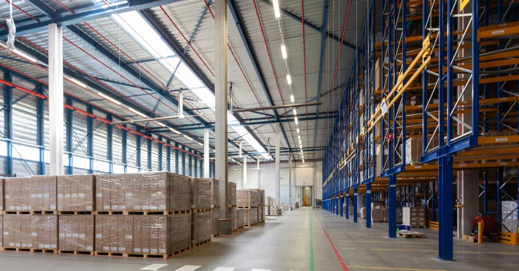
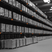
10 اكتشافات من دراسات قياس درجات الحرارة تُحوّل سلامة تخزين الأغذية في جدة دراسة توزيع درجات الحرارة
تُعد سلامة تخزين الأغذية من أهم التحديات التي تواجه المنشآت الغذائية في جدة، نظرًا لدرجات الحرارة المرتفعة والرطوبة العالية الناتجة عن المناخ الساحلي. أي خلل بسيط في التحكم بدرجة الحرارة قد يؤدي إلى تلف المنتجات الغذائية أو فقدان جودتها، مما يشكل خطرًا صحيًا واقتصاديًا. هنا تأتي أهمية دراسة قياس درجات الحرارة كحل أساسي لضمان سلامة…
-
10 Temperature Mapping Discoveries That Transform Food Storage Safety in Jeddah
Food storage safety is a critical concern in Jeddah, where high temperatures, coastal humidity, and large-scale distribution activities place constant pressure on cold storage facilities. Ensuring consistent temperature control is essential for protecting food quality, preventing spoilage, and meeting regulatory standards. This is where a temperature mapping study becomes an indispensable tool for food storage…
-
4 خطط موسمية لدراسة قياس درجات الحرارة لضمان الامتثال المستمر في الرياض دراسة توزيع درجات الحرارة
تواجه المنشآت العاملة في الرياض تحديات موسمية كبيرة تؤثر بشكل مباشر على استقرار درجات الحرارة داخل المباني. فبين الحرارة الشديدة في الصيف وانخفاض درجات الحرارة في الشتاء، يصبح الحفاظ على الامتثال البيئي على مدار العام أمرًا يتطلب نهجًا منظمًا يعتمد على دراسة قياس درجات الحرارة تساعد الخطط الموسمية المدروسة في اكتشاف المخاطر مبكرًا، التحقق من…
-
4 Season-Focused Temperature Mapping Plans for Continuous Compliance in Riyadh
Facilities operating in Riyadh face significant seasonal temperature variations that directly impact indoor environmental control. From extreme summer heat to cooler winter conditions, maintaining compliance throughout the year requires a structured and proactive temperature mapping study approach. Seasonal-focused temperature mapping studies allow organizations to identify risks, validate system performance, and ensure continuous compliance under all…
-
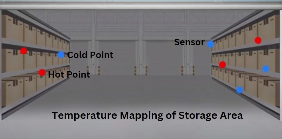
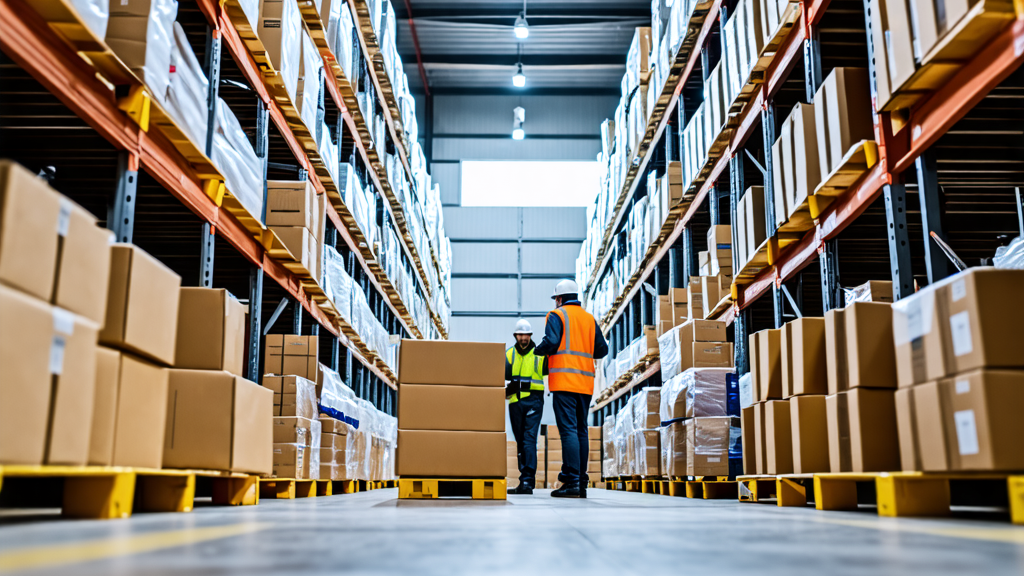
8 مناطق عالية الخطورة داخل المباني في السعودية يتم اكتشافها من خلال دراسة قياس درجات الحرارة دراسة توزيع درجات الحرارة

تعتمد العديد من المنشآت الحديثة في المملكة العربية السعودية على التحكم الدقيق في درجات الحرارة لحماية المنتجات الحساسة وضمان الامتثال التنظيمي واستمرارية العمليات. وعلى الرغم من التصميم الجيد للمباني وأنظمة التكييف، إلا أن هناك مناطق خفية داخل المنشآت قد تشكل مخاطر حرارية كبيرة. هنا تأتي أهمية دراسة قياس درجات الحرارة في الكشف عن هذه المناطق…
-
8 High-Risk Facility Zones in Saudi Buildings Identified Through Temperature Mapping

Modern facilities across Saudi Arabia rely on controlled indoor environments to protect sensitive products, ensure regulatory compliance, and maintain operational efficiency. However, even well-designed buildings can contain hidden risk zones where temperature deviations frequently occur. A comprehensive temperature mapping study is the most reliable way to identify these vulnerable areas and implement effective control measures.…
-
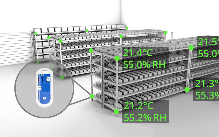
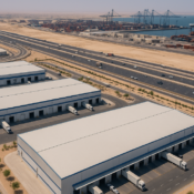
6 إجراءات حماية تعتمد على دراسة قياس درجات الحرارة لتعزيز عمليات سلسلة التبريد في المملكة العربية السعودية دراسة توزيع درجات الحرارة
تلعب عمليات سلسلة التبريد دورًا حيويًا في حماية المنتجات الدوائية، اللقاحات، الأغذية، وغيرها من المنتجات الحساسة للحرارة في جميع أنحاء المملكة العربية السعودية. من مراكز التوزيع الكبرى في الرياض إلى المنشآت اللوجستية الساحلية في جدة والدمام، يُعد الحفاظ على التحكم الدقيق في درجات الحرارة أمرًا بالغ الأهمية. وتُعتبر دراسة قياس درجات الحرارة من أكثر الأدوات…
-
6 Temperature Mapping Safeguards That Strengthen Cold Chain Operations Across Saudi Arabia

Cold chain operations play a critical role in protecting pharmaceuticals, vaccines, food products, and other temperature-sensitive goods across Saudi Arabia. From large distribution hubs in Riyadh to coastal logistics centers in Jeddah and Dammam, maintaining precise temperature control throughout storage and transportation is essential. One of the most effective tools for ensuring cold chain reliability…
-
9 فجوات شائعة في دراسة قياس درجات الحرارة في تخزين الأدوية بالدمام دراسة توزيع درجات الحرارة
تعمل منشآت تخزين الأدوية في الدمام ضمن متطلبات صارمة للحرارة والبيئة لضمان فعالية وسلامة المنتجات الدوائية. وعلى الرغم من توفر أنظمة تكييف متطورة وبنية تحتية حديثة، إلا أن العديد من المنشآت تواجه فجوات خفية في التحكم البيئي. تعتبر دراسة قياس درجات الحرارة أداة أساسية لاكتشاف هذه الفجوات ومعالجتها، لضمان الامتثال التنظيمي وحماية المنتجات الحساسة. تقدم…
-
9 Common Temperature Mapping Gaps Found in Dammam’s Pharmaceutical Storage
Pharmaceutical storage facilities in Dammam operate under strict temperature and environmental requirements to ensure drug potency, efficacy, and safety. Despite sophisticated HVAC systems and modern infrastructure, many facilities still face hidden vulnerabilities. A comprehensive temperature mapping study is essential to identify and close these gaps, ensuring regulatory compliance and protecting sensitive pharmaceutical products. At Redlines,…
Search
Archive
Recent Posts
- 9 تحديات لرسم خرائط درجات الحرارة في الزراعة السعودية — وكيف تحلها الدراسات المتخصصة دراسة توزيع درجات الحرارة

- 9 Temperature Mapping Challenges in Saudi Agriculture — And How Studies Solve Them

- 4 أسباب تجعل دراسة رسم خرائط درجات الحرارة ضرورية لمخازن التبريد المستخدمة في السياحة الغذائية في المملكة العربية السعودية دراسة توزيع درجات الحرارة

- 4 Reasons Temperature Mapping Is Essential for Cold Storage Used in Saudi Food Tourism
- 8 مناطق حرجة لدرجات الحرارة تم اكتشافها في مستودعات الأغذية التي تخدم جدة والدمام دراسة توزيع درجات الحرارة
Gallery