-
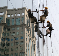
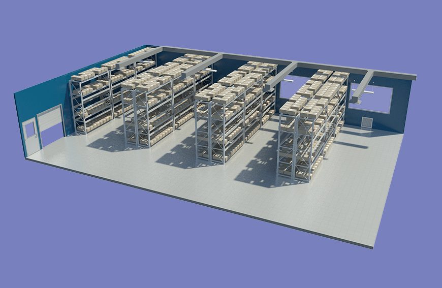
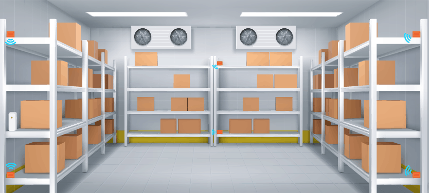
تحسين سلسلة التبريد: دراسة قياس درجات الحرارة لتوزيع المنتجات المجمدة في جميع أنحاء المملكة دراسة توزيع درجات الحرارة
مع تزايد الطلب على الأطعمة المجمدة، الأدوية، والمنتجات الحساسة للحرارة في المملكة العربية السعودية، أصبحت موثوقية سلسلة التبريد ضرورة لا يمكن الاستغناء عنها. فمن مراكز التوزيع الضخمة إلى منافذ البيع المنتشرة في جميع أنحاء المملكة، يجب أن تظل المنتجات المجمدة ضمن نطاقات حرارية دقيقة للحفاظ على جودتها وسلامتها وعمرها الافتراضي. وهنا تأتي أهمية دراسة قياس…
-
Cold Chain Optimization: Temperature Mapping for Frozen Goods Distribution Across the Kingdom
With demand for frozen foods, pharmaceuticals, and sensitive perishable products increasing rapidly across Saudi Arabia, ensuring a reliable cold chain has become essential. From massive distribution centers to retail outlets spread across the Kingdom, frozen goods must remain within strict temperature ranges to maintain their quality, safety, and shelf life. A comprehensive temperature mapping study…
-
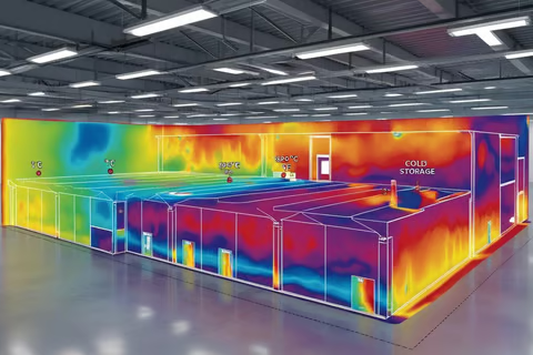
قياس درجات الحرارة خلال صيف السعودية: تقنيات لمنع خسائر المنتجات بسبب الحرارة دراسة توزيع درجات الحرارة
تواجه المملكة العربية السعودية درجات حرارة صيفية من بين الأعلى في العالم، حيث تتجاوز أحيانًا 45°C، مع ارتفاع الرطوبة في المناطق الساحلية مثل جدة والدمام، وحرارة جافة في الرياض. بالنسبة للصناعات التي تتعامل مع الأدوية، الأغذية، مستحضرات التجميل، المواد الكيميائية، والإلكترونيات الحساسة، يمكن لهذه الظروف القاسية أن تسبب تدهور المنتجات وخسائر مالية كبيرة. وهنا تأتي…
-
Temperature Mapping During Saudi Summers: Techniques to Prevent Heat-Related Product Loss

Saudi Arabia faces some of the most intense summer temperatures in the world—often crossing 45°C, with humidity spikes in coastal areas like Jeddah and Dammam, and dry heat waves in Riyadh. For industries handling pharmaceuticals, food, cosmetics, chemicals, and sensitive electronics, these extreme conditions can lead to significant product degradation and financial loss. This is…
-
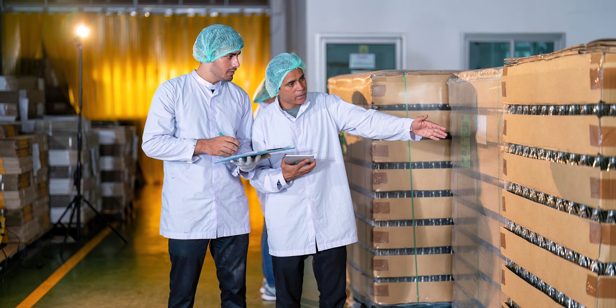
التصميم المبني على البيانات: استخدام رؤى دراسة قياس درجات الحرارة في مشاريع التخزين الجديدة بالرياض دراسة توزيع درجات الحرارة

يتطلب تصميم مرافق التخزين الحديثة للأدوية، الأغذية، وغيرها من المنتجات الحساسة للحرارة في الرياض أكثر من التخطيط المعماري التقليدي. فالحرارة الشديدة في الصيف، والتطور العمراني السريع، والمتطلبات التنظيمية تجعل من الضروري دمج رؤى دراسة قياس درجات الحرارة في مرحلة التصميم منذ البداية. تقدم شركة Redlines خدمات دراسة قياس درجات الحرارة المتخصصة في السعودية، بما في…
-
Data-Driven Facility Design: Using Temperature Mapping Insights in Riyadh’s New Storage Projects
Designing modern storage facilities for pharmaceuticals, food, and other temperature-sensitive products in Riyadh requires more than traditional architectural planning. Extreme summer heat, rapid urban development, and regulatory requirements make it essential to integrate temperature mapping study insights into facility design from the very beginning. At Redlines, we provide expert temperature mapping study services across Saudi…
-
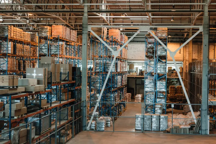
تعزيز كفاءة الطاقة من خلال دراسة رسم خرائط درجات الحرارة في المنشآت الصناعية في الدمام دراسة توزيع درجات الحرارة
تُعد مدينة الدمام واحدة من أهم المراكز الصناعية في المملكة العربية السعودية، حيث تضم مصانع ضخمة، ومراكز لوجستية، ومستودعات واسعة تعمل بشكل متواصل لتلبية احتياجات السوق المحلي والإقليمي. ومع ارتفاع استهلاك الطاقة في هذه المنشآت، أصبحت دراسة رسم خرائط درجات الحرارة خطوة ضرورية للكشف عن فرص التوفير، وتحسين الكفاءة التشغيلية، وتقليل الهدر الحراري. شركة Redlines،…
-
Energy Efficiency through Temperature Mapping in Dammam’s Industrial Facilities
Dammam stands at the heart of Saudi Arabia’s industrial growth, serving as one of the Kingdom’s most active hubs for manufacturing, logistics, warehousing, and distribution. With rising energy costs and increasing pressure to adopt sustainable practices, industrial operators in Dammam are now seeking reliable methods to optimize energy usage without compromising product safety or regulatory…
-
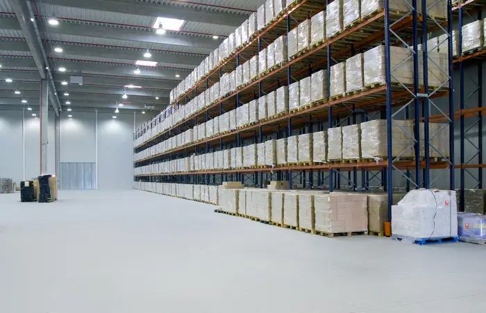
تحديات درجات الحرارة الموسمية في مستودعات جدة: نهج قائم على دراسات الـ دراسة توزيع درجات الحرارة

تُعرف جدة بمناخها الساحلي الرطب ودرجات حرارتها المتقلبة على مدار العام، مما يجعل إدارة المستودعات فيها أكثر تعقيدًا مقارنة بغيرها من مدن المملكة. فالتغيرات الحرارية الموسمية تؤثر بشكل مباشر على جودة المنتجات المخزّنة، خاصة تلك الحساسة للحرارة. ولذلك أصبحت دراسة الـدراسة توزيع درجات الحرارة ضرورة أساسية لضمان استقرار ظروف التخزين. الشركات في المملكة العربية السعودية،…
-
Seasonal Temperature Challenges in Jeddah Warehouses: A Mapping-Based Approach
Jeddah’s coastal climate brings unique storage challenges for businesses operating warehouses across the region. With its high humidity, fluctuating temperatures, and seasonal heatwaves, maintaining product quality becomes increasingly complex—especially for temperature-sensitive goods. This is where the importance of conducting a comprehensive temperature mapping study becomes essential. Businesses throughout Saudi Arabia, particularly in Jeddah, Dammam, and…
Search
Archive
Recent Posts
- 5 فوائد لدراسة رسم خرائط درجات الحرارة لتموين المطارات ولوجستيات أغذية السفر في الرياض دراسة توزيع درجات الحرارة

- 5 Temperature Mapping Study Benefits for Airport Catering & Travel Food Logistics in Riyadh

- 9 تحديات لرسم خرائط درجات الحرارة في الزراعة السعودية — وكيف تحلها الدراسات المتخصصة دراسة توزيع درجات الحرارة

- 9 Temperature Mapping Challenges in Saudi Agriculture — And How Studies Solve Them

- 4 أسباب تجعل دراسة رسم خرائط درجات الحرارة ضرورية لمخازن التبريد المستخدمة في السياحة الغذائية في المملكة العربية السعودية دراسة توزيع درجات الحرارة

Gallery