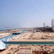

As urban populations rise and cities expand across Saudi Arabia, there is an increasing need to plan neighborhoods that are not just efficient but also climate-responsive. Cities like Riyadh, Jeddah, Dammam, and surrounding regions experience high temperatures for most of the year, making temperature mapping study a vital tool in neighborhood planning.
At Redlines, we specialize in conducting professional temperature mapping study services across Saudi Arabia. Our aim is to help architects, urban planners, and developers understand how temperature behaves across different areas and use that data to build smarter, cooler, and more sustainable neighborhoods.
The Importance of Temperature Mapping Study in Urban Planning
Neighborhoods are made up of various physical elements—buildings, roads, trees, open spaces, and water bodies. Each of these elements absorbs and emits heat differently. As a result, some areas can become significantly hotter than others, especially during summer months. This phenomenon is known as the Urban Heat Island (UHI) effect.
A temperature mapping study helps identify these hot and cool zones and provides valuable data for decision-making. At Redlines, our studies support developers in:
- Understanding temperature differences block by block
- Recognizing zones where overheating could become a problem
- Designing layouts that promote airflow and reduce heat retention
- Choosing the right materials and building orientation

How Temperature Mapping Study Works
Temperature mapping study involves placing temperature sensors across a defined area (like a neighborhood or development site) to monitor and record temperature variations over time. These variations are then visualized through heat maps, allowing planners to see exactly where hot and cool zones exist.
At Redlines, we use high-precision equipment and conduct thorough analysis, taking into account factors such as:
- Time of day and seasonal changes
- Surrounding land use
- Shade and vegetation coverage
- Proximity to heat-reflective surfaces (like asphalt)
We provide our services throughout Riyadh, Jeddah, Dammam, and other regions of Saudi Arabia, tailoring each study to the unique environment and project goals.
Benefits of Temperature Mapping Study in Neighborhood Planning
Implementing data from temperature mapping study into the early stages of design offers several key advantages:
1. Cooler, More Comfortable Living Spaces
By identifying and reducing heat pockets, planners can create residential areas that stay cooler, especially during extreme heat events.
2. Improved Energy Efficiency
Homes and buildings located in cooler microclimates or shaded zones require less energy for air conditioning. This translates to cost savings for residents and a lower carbon footprint.
3. Health and Safety
Excessive heat in urban environments is not just uncomfortable—it’s a public health issue. Temperature mapping study helps mitigate this risk by guiding planners to integrate cooling features like trees, water elements, and ventilation corridors.
4. Strategic Green Space Placement
With accurate temperature data, planners can place parks, green belts, and shaded walkways in areas that need them the most.
Redlines: Your Partner in Smart Urban Development
At Redlines, we believe that every urban space should be designed with the future in mind. Our temperature mapping study services are trusted by government bodies, construction firms, and urban developers across Saudi Arabia, especially in Jeddah, Dammam, and Riyadh.
We offer:
- On-site temperature sensor deployment
- Heat map visualizations and full reports
- Expert consultation for design adjustments
- Climate-conscious urban planning support
Visit us at www.redlines.sa to learn how our services can support your next development.
Final Thoughts
As temperatures continue to rise due to climate change, the role of temperature mapping study in neighborhood planning becomes more critical. By understanding local temperature variations, cities can design communities that are more livable, resilient, and environmentally responsible.
Partner with Redlines today to integrate climate intelligence into your neighborhood planning process — and build the smart cities of tomorrow.